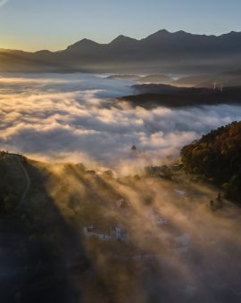
The world beneath our feet is fascinating, but the perspective from above offers an entirely different level of understanding and appreciation. Thanks to advancements in technology, capturing these breathtaking views has become more accessible than ever before, primarily due to the rise of aerial photography drones. These versatile machines are no longer just toys for enthusiasts; they’ve become indispensable tools across a wide range of industries, fulfilling diverse and specific needs with their unique capabilities. This article delves into the various applications of aerial photography drones, highlighting how they’re reshaping industries and offering innovative solutions.
The Foundation: Understanding Aerial Photography Drones
Before exploring their varied applications, it’s crucial to understand what makes aerial photography drones so effective. These unmanned aerial vehicles (UAVs) are equipped with high-resolution cameras and advanced stabilization systems, allowing them to capture stunning photographs and videos from vantage points previously only accessible via helicopters or airplanes. Modern drones boast impressive features such as GPS navigation, obstacle avoidance, intelligent flight modes, and extended flight times. This combination of technology allows for precise control, safe operation, and the ability to capture data in a variety of environments.
1. Real Estate: A Bird’s Eye View for Buyers
The real estate industry has been revolutionized by aerial photography drones. Static ground-level images often fail to capture the true essence of a property and its surrounding environment. Aerial shots, however, provide a comprehensive overview, showcasing the size of the land, landscaping features, proximity to amenities, and the overall neighborhood.
- Marketing Advantage: Aerial photography drone footage is a powerful marketing tool, adding a touch of luxury and professionalism to property listings. Videos showcasing panoramic views and smooth camera movements can generate significant interest and attract potential buyers.
- Property Assessment: Beyond marketing, drones are used for property inspections, particularly for assessing roof conditions, identifying potential structural issues, and conducting detailed land surveys.
- Construction Progress Monitoring: Developers use drone imagery to track construction progress, monitor site activity, and identify potential delays or safety hazards.
2. Construction and Infrastructure: Precision and Efficiency
The construction and infrastructure industries benefit immensely from the data collection capabilities of aerial photography drones.
- Site Surveying and Mapping: Drones equipped with LiDAR (Light Detection and Ranging) technology can create highly accurate 3D models of construction sites, enabling precise measurements, volume calculations, and terrain analysis.
- Progress Monitoring and Documentation: Regular drone flights provide visual records of construction progress, allowing project managers to track milestones, identify potential bottlenecks, and ensure adherence to project timelines.
- Infrastructure Inspection: Bridges, power lines, and other critical infrastructure can be inspected safely and efficiently using drones, reducing the need for costly and potentially hazardous manual inspections. Drones can identify corrosion, structural damage, and other issues, allowing for proactive maintenance and preventing costly failures.
- Safety Monitoring: Drones can be used to monitor site safety, identifying potential hazards and ensuring compliance with safety regulations.
3. Agriculture: Smart Farming with a View from Above
Precision agriculture is another area transformed by aerial photography drones. By capturing multispectral imagery, drones can provide farmers with valuable insights into crop health, irrigation needs, and potential disease outbreaks.
- Crop Health Monitoring: Multispectral cameras detect variations in chlorophyll levels, indicating areas of stress or disease. This allows farmers to take targeted action, optimizing fertilizer application and preventing widespread crop damage.
- Irrigation Management: Drones can identify areas of water stress, allowing farmers to optimize irrigation schedules and conserve water resources.
- Yield Estimation: By analyzing plant density and health, drones can provide accurate yield estimations, allowing farmers to plan harvesting and marketing strategies effectively.
- Livestock Monitoring: Drones can be used to monitor livestock herds, tracking their movements, identifying sick or injured animals, and ensuring their overall well-being.
4. Environmental Monitoring and Conservation: Protecting Our Planet
The ability to capture data remotely and efficiently makes aerial photography drones invaluable tools for environmental monitoring and conservation efforts.
- Wildlife Monitoring: Drones can be used to track wildlife populations, monitor their behavior, and identify potential threats to their habitats.
- Forest Management: Drones can assess forest health, monitor deforestation rates, and identify areas at risk of wildfires.
- Pollution Monitoring: Drones equipped with specialized sensors can detect air and water pollution, helping to identify sources and monitor the effectiveness of remediation efforts.
- Disaster Response: In the aftermath of natural disasters, drones can quickly assess damage, locate survivors, and deliver critical supplies.
5. Law Enforcement and Security: Enhanced Safety and Surveillance
Law enforcement agencies are increasingly utilizing aerial photography drones for a variety of applications, enhancing safety and improving surveillance capabilities.
- Crime Scene Investigation: Drones can capture detailed aerial images of crime scenes, providing valuable evidence for investigators.
- Search and Rescue Operations: Drones equipped with thermal cameras can be used to locate missing persons, particularly in challenging terrain or during nighttime hours.
- Crowd Control: Drones can monitor large crowds, identify potential security threats, and provide situational awareness to law enforcement officers.
- Border Patrol: Drones can patrol borders, detecting illegal crossings and assisting border patrol agents in apprehending suspects.
6. Media and Entertainment: Capturing Stunning Visuals
From blockbuster movies to captivating documentaries, aerial photography drones have become essential tools for media and entertainment production.
- Filmmaking: Drones provide filmmakers with the ability to capture stunning aerial shots, adding a new dimension to their storytelling.
- Documentary Production: Drones can capture breathtaking footage of natural landscapes, wildlife, and cultural events, enriching documentary narratives.
- Journalism: Drones allow journalists to capture unique perspectives on news events, providing viewers with a more comprehensive understanding of the situation.
The Future of Aerial Photography Drones: Innovation and Expansion
The applications of aerial photography drones are constantly evolving as technology advances. We can expect to see even more sophisticated drones with enhanced capabilities, including:
- Improved battery life: Longer flight times will enable drones to cover larger areas and collect more data.
- Advanced sensors: The integration of new sensors will allow drones to collect a wider range of data, including thermal imagery, gas detection, and radiation monitoring.
- Artificial intelligence: AI-powered drones will be able to analyze data in real-time, making autonomous decisions and providing actionable insights.
- Increased autonomy: Drones will become more autonomous, capable of flying complex missions without human intervention.
Conclusion: A Powerful Tool for a Variety of Needs
Aerial photography drones have proven to be powerful and versatile tools with diverse applications across various industries. From real estate to agriculture, construction to environmental monitoring, these flying machines are revolutionizing how we collect data, solve problems, and interact with the world around us. As technology continues to advance, the potential applications of aerial photography drones are virtually limitless, promising even greater efficiency, innovation, and positive impact in the years to come. The sky is truly the limit for this transformative technology.